Diamond Creek SWA
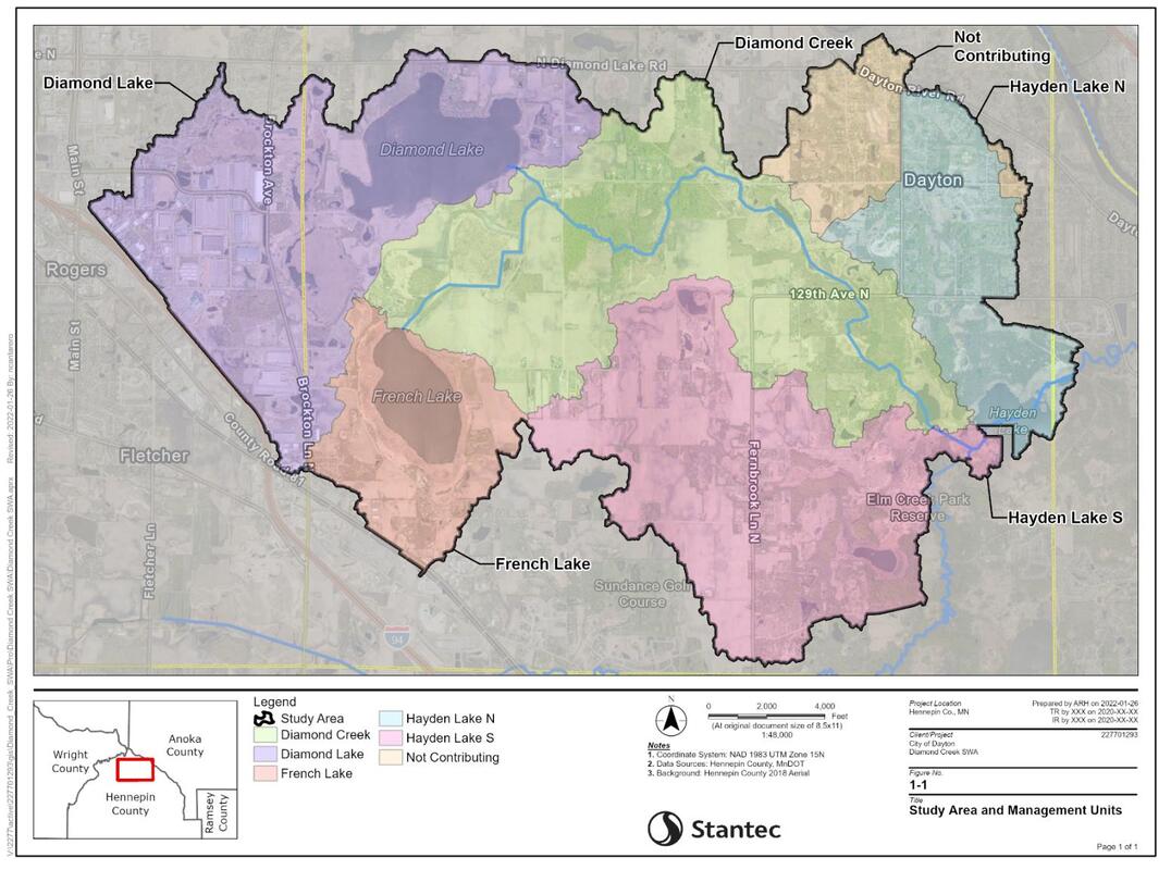
The City of Dayton and the Elm Creek Watershed Management Commission undertook this SWA because several of the lakes and streams in the Elm Creek watershed do not meet state water quality standards and the cities are required to reduce the amount of pollutants conveyed to them. The study looked at areas in Dayton, Rogers, and Champlin draining to French, Diamond and Hayden Lakes and Diamond Creek to identify possible practices to reduce those pollutants, and then review them with land owners to see which are most feasible. The team that undertook the SWA included city, watershed, county, Three Rivers Park District, hydrology, engineering and agricultural management specialists who know this area as well as landowners who can bring their practical knowledge and expertise to the SWA. The SWA looked at both agricultural and developed areas. In addition, the study looked at potential options for managing the “internal load” of French and Diamond Lakes.
The results of the SWA is being used to help landowners, cities, and other interested parties find the best, most cost-effective ways to improve water quality in the lakes and Diamond Creek. The SWA will also be helpful in applying for grant funding to help landowners and cities undertake voluntary pollutant- removing practices. This SWA was performed in the overall area mapped below.
The Final Report can be viewed here.