Rush Creek SWA
The Elm Creek Watershed Management Commission performed this SWA because several of the lakes and streams in the Elm Creek watershed do not meet state water quality standards and the cities are required to reduce the amount of pollutants conveyed to them. The subwatershed assessment will “zoom in” on land in the area that is the headwaters for Rush Creek and the Rush Creek South Fork, including Henry Lake and Jubert Lake, to identify possible practices to reduce those pollutants, and then review them with land owners to see which are most feasible. The team that undertook the SWA included city, watershed, hydrology, engineering and agricultural management specialists who know this area as well as landowners who can bring their practical knowledge and expertise to the SWA. The SWA looked at both agricultural and developed areas,
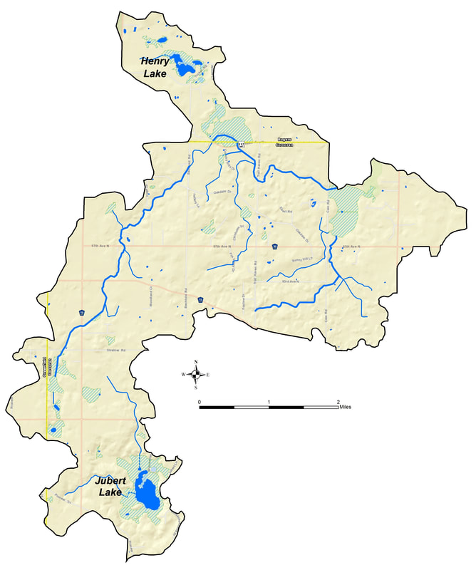
The results of the SWA is being used to help landowners, cities, and other interested parties find the best, most cost-effective ways to improve water quality in Rush Creek and Henry and Jubert Lakes. The SWA will also be helpful in applying for grant funding to help landowners and cities undertake voluntary pollutant- removing practices. This SWA was performed in the overall area mapped below.
The Final Report and accompanying Appendices can be viewed here.
The SWA is also segmented into six specific Management Units. Map books for each individual units can be found in the links below.
Catchment Overview
Lake Henry Map Book
Lake Jubert Map Book
Upper Rush Creek Map Book
Lower Rush Creek Map Book
Tiltons Map Book
The Elm Creek Watershed Management Commission performed this SWA because several of the lakes and streams in the Elm Creek watershed do not meet state water quality standards and the cities are required to reduce the amount of pollutants conveyed to them. The subwatershed assessment will “zoom in” on land in the area that is the headwaters for Rush Creek and the Rush Creek South Fork, including Henry Lake and Jubert Lake, to identify possible practices to reduce those pollutants, and then review them with land owners to see which are most feasible. The team that undertook the SWA included city, watershed, hydrology, engineering and agricultural management specialists who know this area as well as landowners who can bring their practical knowledge and expertise to the SWA. The SWA looked at both agricultural and developed areas,
The results of the SWA is being used to help landowners, cities, and other interested parties find the best, most cost-effective ways to improve water quality in Rush Creek and Henry and Jubert Lakes. The SWA will also be helpful in applying for grant funding to help landowners and cities undertake voluntary pollutant- removing practices. This SWA was performed in the overall area mapped below.
The Final Report and accompanying Appendices can be viewed here.
The SWA is also segmented into six specific Management Units. Map books for each individual units can be found in the links below.
Catchment Overview
Lake Henry Map Book
Lake Jubert Map Book
Upper Rush Creek Map Book
Lower Rush Creek Map Book
Tiltons Map Book